From Mud to Mendenhall
ENSM PhD alum Dr. Dan Ciarletta checks out the past, present – and likely future – of coastal sediments
Posted in: Program Alumni
Time is repetitive, the past constantly informing the future. The mantra, “If I dig down deep enough” (pun intended), is what inspired my research at Montclair State University. As an environmental scientist with a focus in coastal geology/geomorphology, I’m sort of a historian at heart, searching for answers in the archives of the Earth. Using and developing models informed by real-world observations, my goal is to infer the sensitivity of coastal systems to changes: in the past, now – and in the future, for example, from the increasing rate of sea-level rise as the ocean warms and land ice melts. Today, I’m continuing this line of research at the United States Geological Survey under a Mendenhall postdoctoral fellowship, a development I owe to my experience in Montclair’s Environmental Science and Management (ENSM) PhD program.
For me, one of the most important aspects of the program was the friendship and support of my fellow students. No PhD student exists in a vacuum, and particularly during the early years of required classes, I relied on my colleagues to keep me focused and to expand my horizons. The latter is especially relevant to Montclair, where the ENSM program is a broad mixture of Earth, economic, and biological sciences. It ensured I was never pigeon-holed in my research, giving me the opportunity to learn new techniques from budding scientists with entirely different backgrounds.
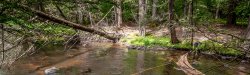
Timelapse of coastal change at Honeymoon Island, Florida from 1984 to present using images from Landsat.
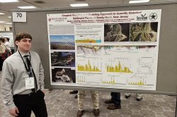
Maybe it was no surprise that I gravitated to modeling, even though it was something I initially never thought I would do (new students take note: this might be true for you too!). By its nature, modeling is interdisciplinary, being applicable to not only a multitude of Earth systems, but also evaluating data and parameters generated by an endless array of techniques—it forces you to wear different hats, as some would say. In fact, in my research at MSU, I had hats for field geology, remote sensing, geography, and stratigraphy, and maybe a few other disciplines I’m forgetting in the moment. Some days I was tromping around the marshes of Parramore Island, Virginia, collecting hand auger samples, and other days I was making time-lapse movies of coastal change from sequences of satellite images. Together, these experiences gave me the skills to do cutting edge and stimulating science, and moreover, opened the door to a postdoc I can be passionate about.