
Anthropology Students Use Digital Tools to Expose Hidden History
Posted in: Archeology, Digital Humanities, Field Work

Setauket, New York is a village on the north shore of Long Island with deep historical roots. Tales of colonial settlers abound, but the stories of the Native Americans and African Americans who made the place home for hundreds of years are often overlooked in historical narratives.
A collaborative team, including Christopher N. Matthews, professor in the Department of Anthropology, has been working to change that.
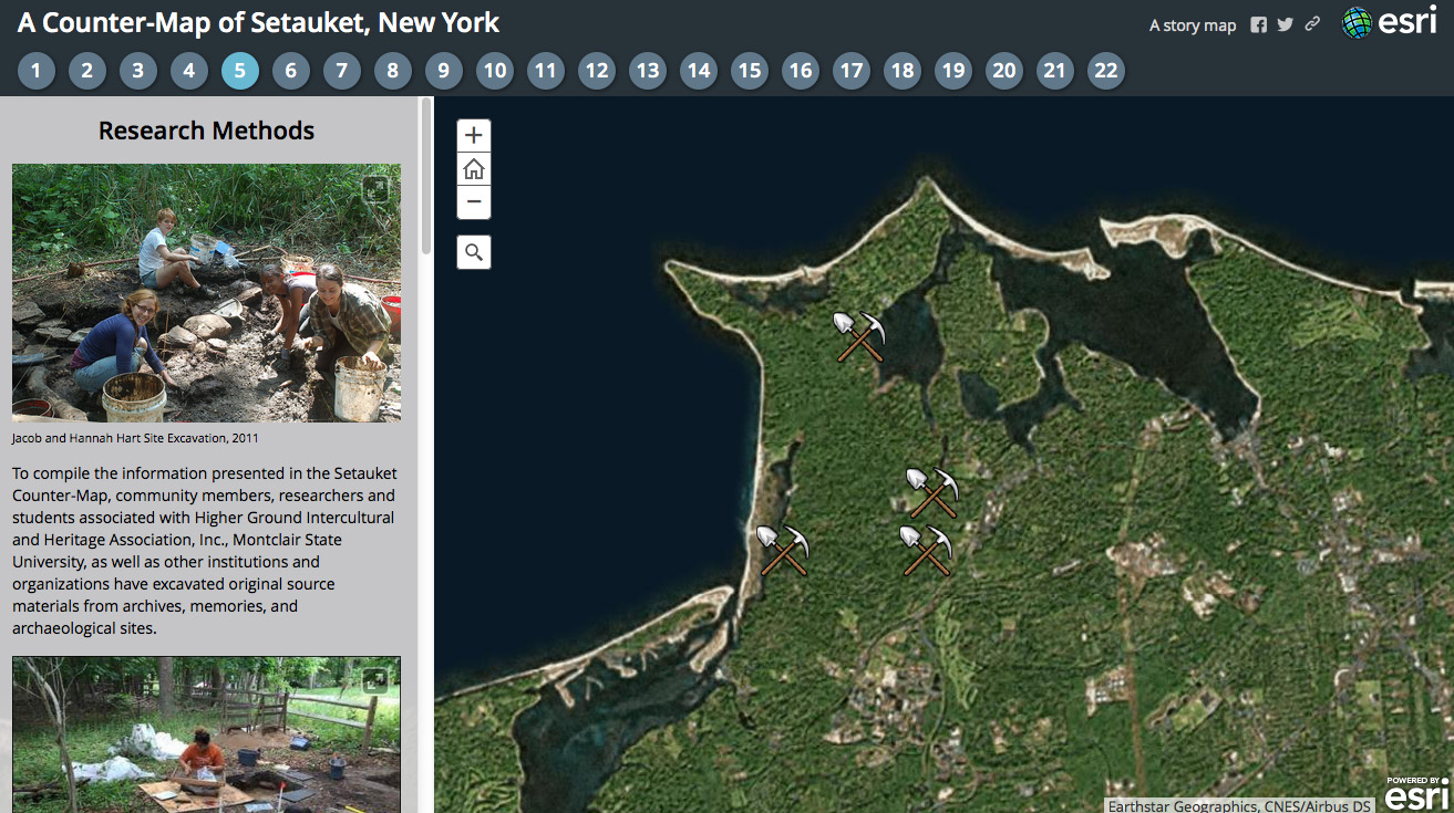
A historical and archaeological study of the long-standing community in the Bethel-Christian Avenue-Laurel Hill Historic District began in 2009. This summer, Matthews, along with two students, Alexis Alemy and Sophia Hudzik, released an interactive map as a dynamic and informative way to present their discoveries.
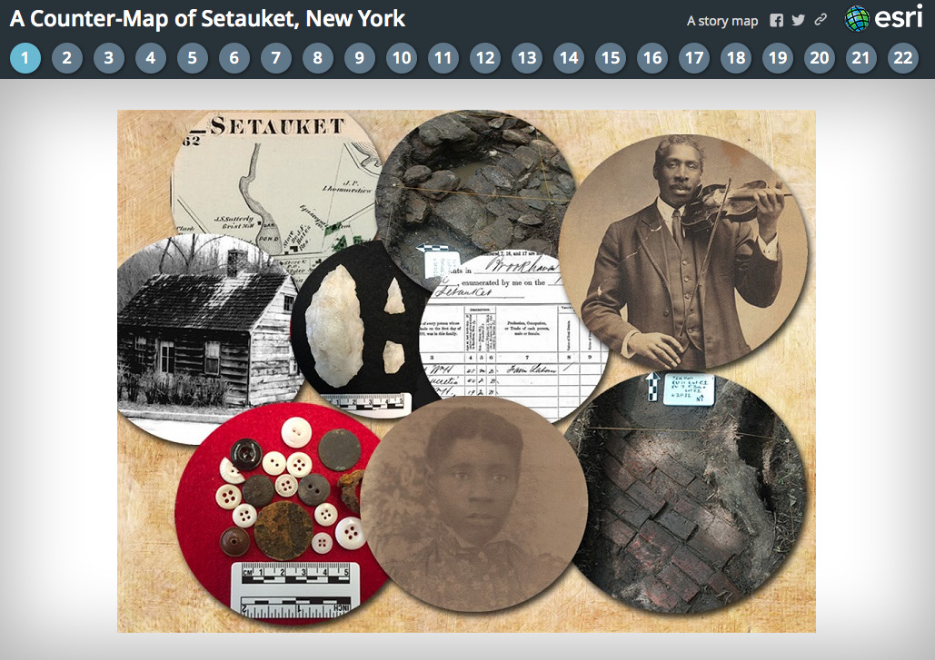
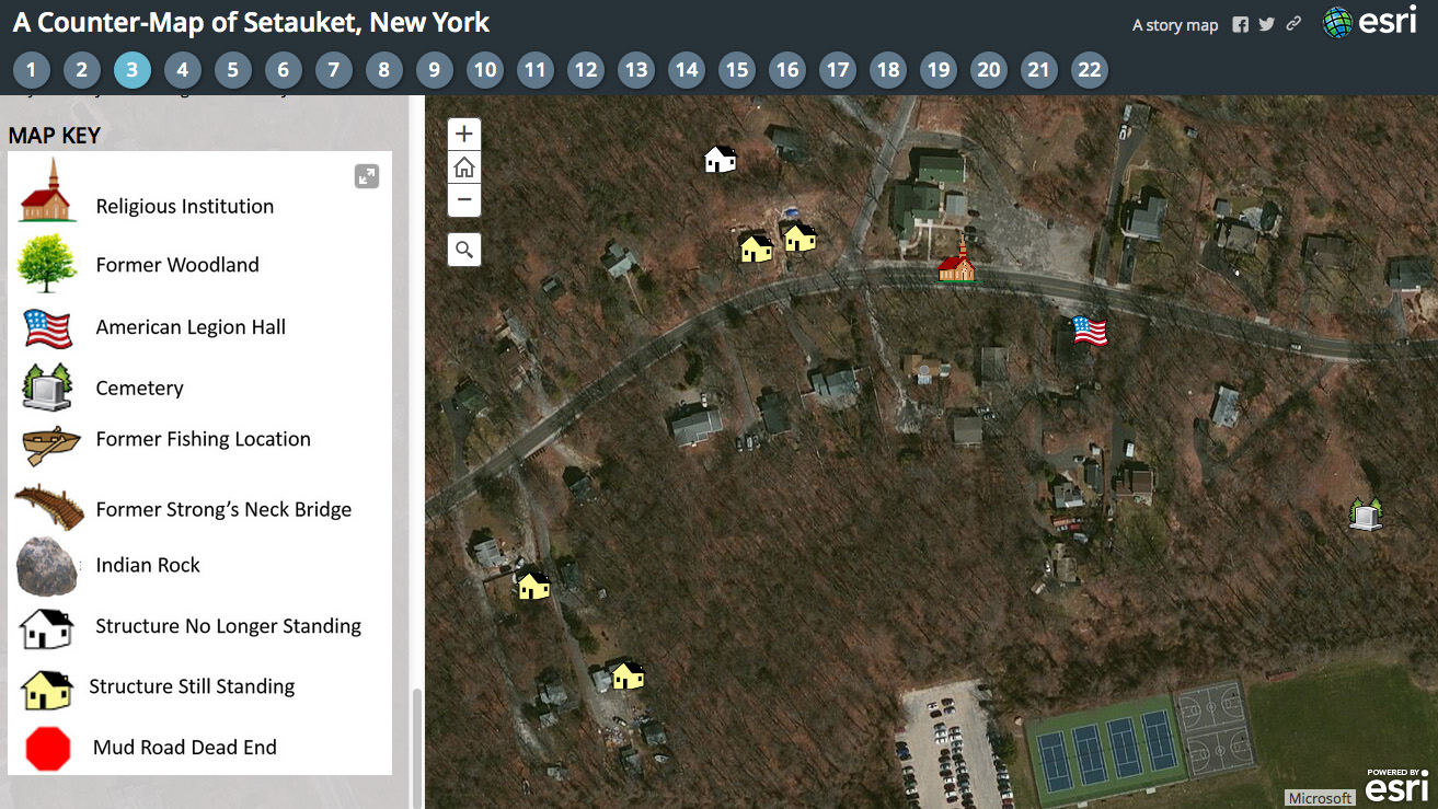
Called A Counter-Map of Setauket, New York, this Digital Humanities initiative is produced on the ArcGIS ‘Story Map‘ platform created by ESRI. It features photos, historical documents, details on excavation finds, coordinates embedded in a Google Earth map, and more.
Click on an image below to enlarge photo.
“Story maps can be of vital use to archaeologists and other researchers by providing a low cost, relatively easy way to make scholarship available to the public in an accessible and exciting online format,” wrote Alemy and Hudzik in an article about the project on the Society of Historical Archaeology website.
The trio also wrote about the project for an article published on the Society for American Archaeology’s Current Research Online site.
A Long Time Coming
Called “A Long Time Coming,” the study of the Bethel-Christian Avenue-Laurel Hill Historic District is a collaborative effort supported by community members, researchers and students associated with Higher Ground Intercultural and Heritage Association, Inc., Montclair State University, Hofstra University, and Education Works. Key leadership includes Robert Lewis (Higher Ground), Chris Matthews, and Judith Burgess (Education Works).
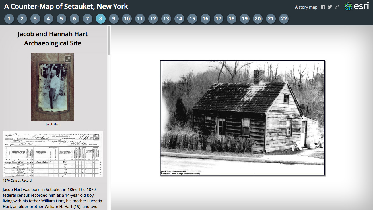
As part of the study, Matthews led excavations at two sites: Jacob and Hannah Hart home and the Silas Tobias home. The well-preserved Hart site was excavated in 2011 and 2015. It yielded finds including a quartz lithic tool, a wide range of buttons, a straight pin, a thimble, and a sewing oil bottle fragment. Descendants of the homeowners still live in and around Setauket.
Excavation of the Tobias site in 2015 yielded more than 15,000 artifacts including 500 quartz tools and flakes from stone tool making and use as well as everyday materials such as shards from dishes, bottles, and windows, as well as personal items like clay tobacco pipe fragments and shoe parts.
Researchers also gathered materials from historical archives and conducting oral histories.
Project background: Past and future
The ground-breaking project has been written about multiple times in the press with articles including: “Fighting to Preserve a Chapter of Setauket History” by the New York Times, “Digging for Yesterday” by the Long Island Life, “Where blacks, Native Americans share community” by Newsday, and “Archaeological Dig Wraps in Setauket” by Patch.com.
As noted above, the Montclair students wrote about the Counter-Map project for two online publications. They also submitted the project to a storymap contest. Matthews has published findings from the excavations in scholarly publications and is working on a book-length manuscript.
The Higher Ground Intercultural and Heritage Association is working with Historical New York Research Associates to create a detailed Cultural Resource Survey documenting the significance of dozens of local neighborhood landmarks. It’s to support a pending application to add the Bethel-Christian Avenue sites to the National Register for Historic Places.