Denizens
Chopping, Mark
- Degrees
- MPhil, University of Cambridge (England)
- PhD, University of Nottingham (England)
Mark Chopping is a professor in the Department of Earth and Environmental Studies and Director of the PhD program in Environmental Science and Management. He has been working in terrestrial remote sensing since 1993, when he took a position as a research assistant in a University of Cambridge research project. Since December 2003 he has served as principal investigator in a number of projects funded by NASA’s Earth Science programs, with foci on the use of NASA’s Multiangle Imaging SpectroRadiometer (MISR), Moderate Resolution Imaging Spectroradiometer (MODIS), and high resolution imagery from commercial Earth-observing satellites for mapping vegetation structure in diverse environments. He has been a member of the NASA MISR Science Team since 2004 (co-I since 2008), the NASA Terrestrial Ecology Science Team (2008-), and more recently the NASA ABoVE Science Team (2015-).
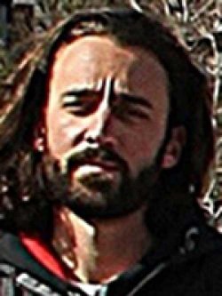
Radakovic, Darko
- Advisor
- Chopping
- Degrees
- MS Earth Science, BS Earth Science at the University of Amsterdam
- Affiliations
- NASA ABoVE Science Team, MSU Remote Sensing Laboratory
Darko’s research is focusing on the effects of climate change on tall shrubs in the Alaskan and Canadian regions by combining Dr. Mark Chopping’s CANAPI, CANAPAMI and CANAPANI tall shrub detection software with high resolution satellite imagery from the National Geospatial-Intelligence Agency as part of NASA’s Arctic-Boreal Vulnerability Experiment (ABoVE).
Cortes, Isamar
- Advisor
- Lorenzo-Trueba
- Office
- CELS Computational Suite
- Degrees
- MS Earth and Environmental Science, BS Sustainability Science, BA Geography
- Affiliations
- Lorenzo-Trueba Lab, CIRES, MSU Remote Sensing Lab
Isamar is studying the effects of climate conditions on mangrove ecosystems, using remote sensing and numerical modeling. Her work explores how average net evaporation affects Caribbean mangrove islands; new research will investigate how seasonal variations affect mangrove ecosystems through zonation and die off, using Landsat imagery to study changes in mangrove islands across the Caribbean. The work will focus on: the role of average net evaporation on the spatial distribution of mangrove ecosystems; trends in the seasonal effects of net evaporation; and the combined effects of tides as sea level rises.
Kolodin, Jesse
- Advisor
- Lorenzo-Trueba
- Office
- CELS 232
- Ext
- x5423
- Degrees
- BS in Economics
- MS in Geosciences with a concentration in Coastal Geomorphology
Ex-denizens
- Bao Gang
- Phillip Gomez
- Dr. Rocio Duchesne
- Dr. Tian Yao
- Dr. Sagarika Roy
- Aslan Aslan
- Professor Sawahiko Shimada (2009-10)
- Faith Justus
- Liangjie Zhu
- Lawrence Galiano
- Lindsey Shanks (M.S. Earth and Environmental Science, Spring 2017)
Thesis: “Targeting SAV Restoration at Lake Mattamuskeet Using GIS and Landsat 8 Data”