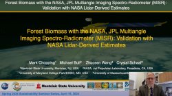
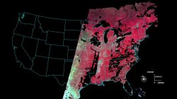
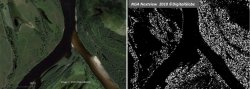
Forest Biomass with the NASA, JPL MISR: Validation with NASA Lidar-Derived Estimates
Dr. Mark Chopping presents a Sustainability Seminar Talk
July 30, 2025

Dr. Mark Chopping presents a Sustainability Seminar Talk
July 30, 2025
Manuscript in review
July 30, 2025
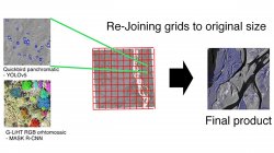
Spring 2025 Sabbatical Project Progress for Dr. Mark Chopping
July 30, 2025
Held in San Diego, California, January 23-26, 2023
July 3, 2023
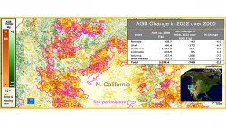
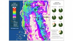
Dr. Mark Chopping, Professor, Earth and Environmental Studies, and colleagues have published NASA-funded research to map aboveground biomass and disturbance in southwestern forests using multi-angle imaging.
April 11, 2022
Variability of Vegetation Net Primary Productivity on the Mongolian Plateau 1982 – 2010 and its Response to Climate Change
October 16, 2015
A High-Resolution Delineation of the Circumpolar Taiga-Tundra Ecotone
October 16, 2015
Changes in Shrub Abundance in Arctic Tundra from the Satellite High Resolution Record for the Arctic-Boreal Vulnerability Experiment and Impacts on Albedo
August 28, 2015