
The Urban Heat Island Effect
Dr. Greg Pope, Department Chair, has work on the urban heat island effect referenced in piece regarding increasing temperatures in NJ cities
Posted in: Department Research, In the Media
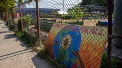
The Ironbound site of Down Bottom Farms, at the corner of Ferry and St. Charles Streets, is surrounded by a largely working-class immigrant population. It’s an area Rodriguez describes as “forgotten” because it’s not picturesque, and lacks the iconic restaurants of the stretch of Ferry Street just to the west.
The neighborhood is packed with black-top and concrete, transitioning from residential to industrial. Trees, or any greenery for that matter, are hard to find. That environment amplifies the area’s temperature, often contributing to sweltering heat in the summer.
The problem, called the urban heat island effect, was documented in New Jersey cities 15 years ago by Greg Pope, now Department Chair of Earth and Environmental Studies at Montclair State University.
It mainly has to do with the lack of vegetation. What happens with an urban heat island, the urban surfaces, like pavement, cement and brick, and rooftops, they do a better job of absorbing heat during the day and then releasing it at night.
The problem extends throughout the neighborhood, according to Rodriguez, who grew up nearby at the Newark Housing Authority’s Hyatt Court complex and lives in the Ironbound today. She said the heat difference is noticeable even within the city, pointing out that leafy Branch Brook Park and surrounding areas in the North Ward typically feel cooler than her part of the city.
“Here we don’t have that, so it gets unbearably hot,” Rodriguez said. “You’re sweating, probably, walking a couple of feet.”
Recent research links the Ironbound’s problem to historically racist urban planning measures.
In the 1930s and ’40s, federal housing officials published maps showing where banks should make loans, starting the process of “redlining” neighborhoods with predominantly Black and immigrant populations, said Jeremy Hoffman of the Science Museum of Virginia. Those neighborhoods ended up with fewer trees, more pavement, and less public investment.
Essex County was one of the places mapped, and the Ironbound became one of those redlined neighborhoods. The area was described by federal officials in 1939 as a slum, and categorized as hazardous.
Over the decades, residents of redlined areas — denied the opportunity of home ownership — could not gain the economic and political power to improve their surroundings, Hoffman said. Often, local governments instead focused amenities on “better” neighborhoods with single-family houses.
“It’s really an 80-year story of denying the ability to gain generational wealth,” Hoffman said.
His team of researchers paired redlining maps of 108 American communities — including Atlantic City, Camden, Trenton and parts of North Jersey in the greater New York City area — with maps showing where summer heat hits hardest today. The connection was unmistakable, with redlined neighborhoods an average of almost four degrees hotter on average, and in some cases 17 degrees hotter, even in the same city.
Hoffman said decades of disinvestment and discriminatory planning left minority neighborhoods sweltering while wealthier areas cooled with parks, grass and shady trees.
“Even without climate change, these areas of our cities would already be warmer,” Hoffman said.
Read the full article on Climate Central